Project Map

Experimental Transect

Hello world!

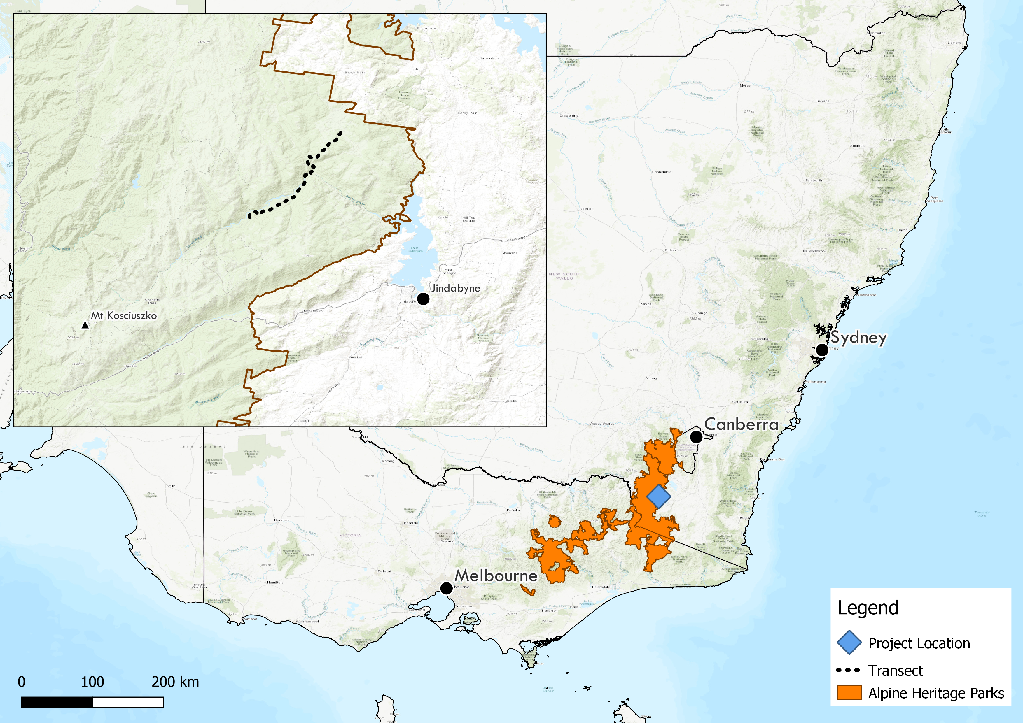
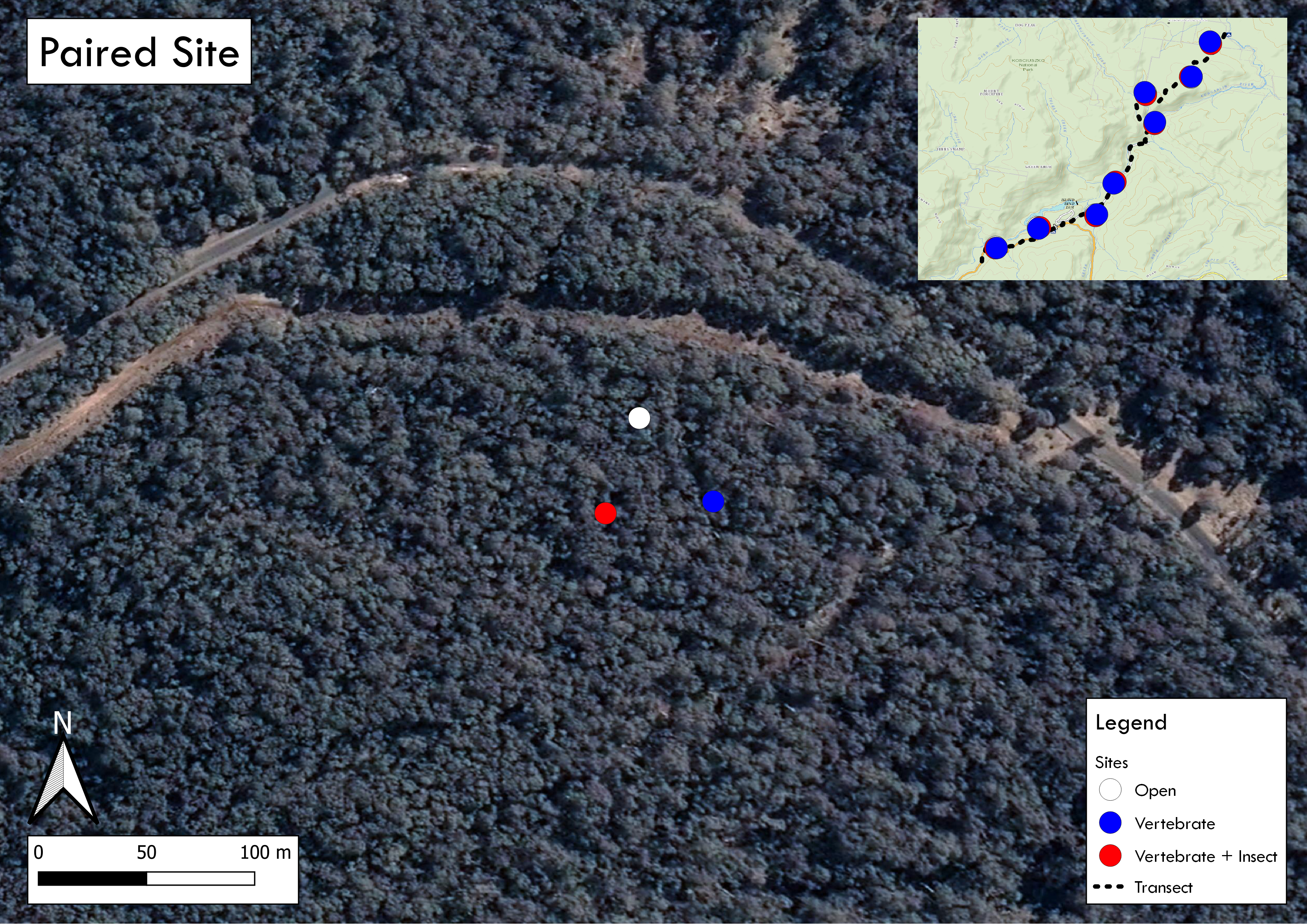
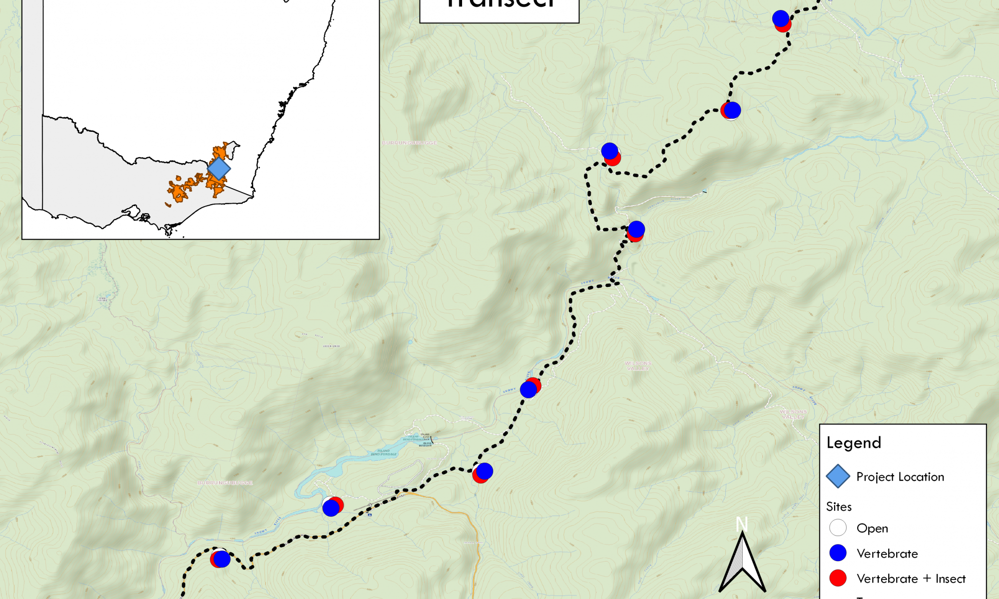
I’d like to share some maps I’ve made of my master’s project. I’ve conducted an ecological project looking at scavenging dynamics in the Australian Alps, specifically in Kosciuszko National Park in New South Wales. The maps show the Australian Alps (the highest region in mainland Australia) and my autumn replicate transect. The transect runs along Island Bend Fire Trail and Guthega road. Each site is roughly 1km distance from each other with treatments approximately 50m from one another.

Each site consists of three treatments 1) Open / No Exclusion, 2) Vertebrate Exclusion, and 3) Vertebrate + Insect Exclusion.

These maps were produced with QGIS version 3.2+.

WIRES Vet Map

WIRES Vet Map

A while back I created a map to help out the WIRES call center operators more quickly identify associated veterinary practices around incoming wildlife rescue calls. Although they may have moved on to different technology since then, here is a public version of the map I’ve created. Who knows this may still help any interested member of the public identify nearby triage centers if they’ve found any injured Australian wildlife in New South Wales they’d like to help out.

The map includes the WIRES regions as well as other wildlife rescue organizations that operate in tandem. Vet practices have been organized into categories of hours of operation as well as specialty. The full-size version includes the all important search function which allows the user to pinpoint a location using Google Maps and helps identify the closest center around with the corresponding layers.

A full size version of the map can be found here